About Our Emergency Management System
Integrated Fire/Wildfire
Management System

iPROTECT: Integrated Fire/Wildfire Preparedness, Response Optimization, and Emergency Management System
Why Choose iProtect: iProtect stands as the premier choice for fire management agencies, emergency responders, and policymakers, offering a user-friendly interface, advanced simulation capabilities, and real-time data integration. Its ability to simulate different scenarios and provide actionable insights enhances preparedness and response efforts, ultimately reducing the risk and impact of wildfires.
Description: iPROTECT, developed by INFRALABS Ltd, is an advanced wildfire management and response platform designed to empower stakeholders in effectively mitigating the impact of wildfires. With its cutting-edge features, iPROTECT enables users to assess fire risk, predict fire behavior, and implement strategic responses to protect lives and property. It offers a suite of capabilities, including the creation of ignition probability maps, calculation of fire behavior, GIS functionalities, fleet management, and evacuation planning, providing stakeholders with valuable tools to make informed decisions and coordinate wildfire response efforts.
Platform Overview: The iProtect fire simulation platform comprises three logical subsystems: the Meteorological Data Collector, Fleet Management, and GIS Simulation Interface. The Meteorological Data Collector gathers meteorological data and forecasts, while Fleet Management stores data collected from moving entities. The GIS Simulation Interface serves as the primary user interface, offering graphical representation and various modules for simulations and planning.
Fire Simulation Model: The fire simulation model within iProtect leverages historical and real-time data to deliver unparalleled accuracy in forecasting fire spread trajectories. By analyzing meteorological conditions, fuel types, and terrain characteristics, the model enables stakeholders to visualize potential scenarios and explore firefighting strategies effectively.
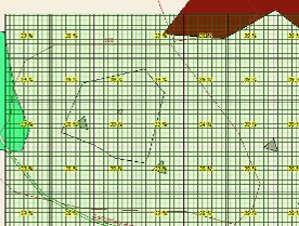
- Advanced Capabilities: Creation of Ignition Probability Maps: iPROTECT allows for the creation of ignition probability maps, which provide a visual representation of areas with higher likelihoods of ignition, aiding in risk assessment and preemptive measures.
- Calculation of Fire Behavior: The platform computes fire behavior by analyzing relevant parameters, enabling the simulation of fire dynamics. This simulation facilitates the prediction of fire spread patterns and intensity under different conditions.

- GIS Capabilities: iPROTECT offers Geographic Information System (GIS) capabilities, including:
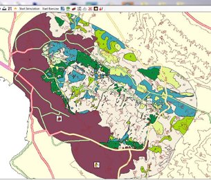
- Cartographic representation of fuel models: Visualization of fuel models on maps, aiding in assessing fuel loads and fire behavior predictions.
- Dynamic modification of fuel areas: Ability to update and modify fuel areas in real-time, allowing for adaptive fire management strategies.
- Dynamic modification of areas with different moisture levels: Capability to adjust areas with varying moisture levels, influencing fire behavior predictions and response strategies.
- Fleet Management: Management of moving entities, such as firefighting units, for efficient deployment and coordination.
- Evacuation Plan: Development and management of evacuation plans to ensure the safe evacuation of communities during wildfire emergencies.

Outputs: The platform generates various outputs, including simulation results, fire spread probability maps, evacuation plans, and recommendations for firefighting strategies. These outputs assist stakeholders in understanding wildfire dynamics and implementing proactive measures to mitigate the impact of wildfires effectively.
Impact: The adoption of iProtect significantly improves wildfire management practices by enabling proactive decision-making, optimizing resource allocation, and enhancing coordination among stakeholders. By facilitating efficient response strategies, iProtect contributes to minimizing property damage, protecting ecosystems, and safeguarding human lives in areas prone to wildfires.
For more info please Contact Us


